My last visit to Havasupai was cut short by a day due to potential rainfall on my last day. So there were a few places that I didn’t get a chance to check out.
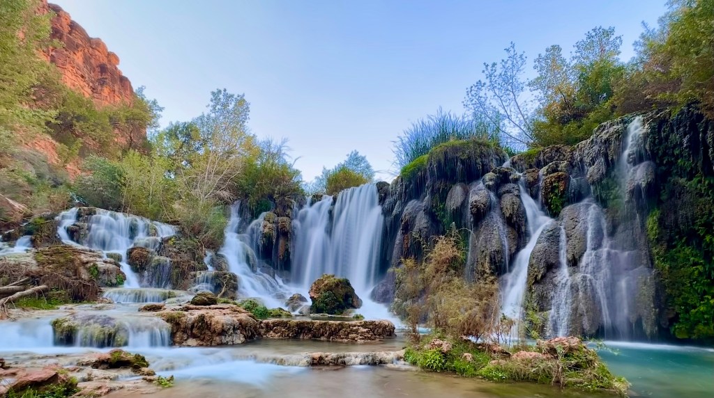
Hidden Falls is one of the least visited waterfalls due to its relatively hard to find and hidden location. The fact that the trail abruptly ends in the creek with no obvious onward path leads the majority of the people to turn around and never make it to the end. This is where I met one of my solo hiking partners – Lori from Wisconsin. Truth is I hadn’t been looking for this particular trail, but I spotted Lori from above walking alone and kept an eye on her, one out of curiosity, and two out of concern. The trail was relatively remote and I had wanted to make sure she was going to be safe. When she dropped out of view I decided to follow her.
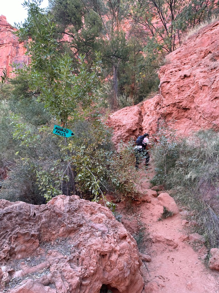
This sign is not at the beginning of the trail. It is located way past where it’s visible from the main hiking path.The fact is you can actually see this waterfall from above on the main trail, but getting there is a different story.Hidden falls up close, and a perfect swimming hole in the summer.
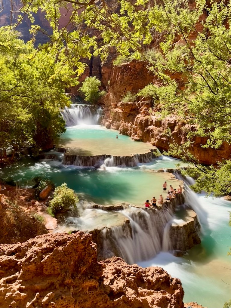
Little Navajo Falls, located upstream to hidden falls, was much easier to find.
..
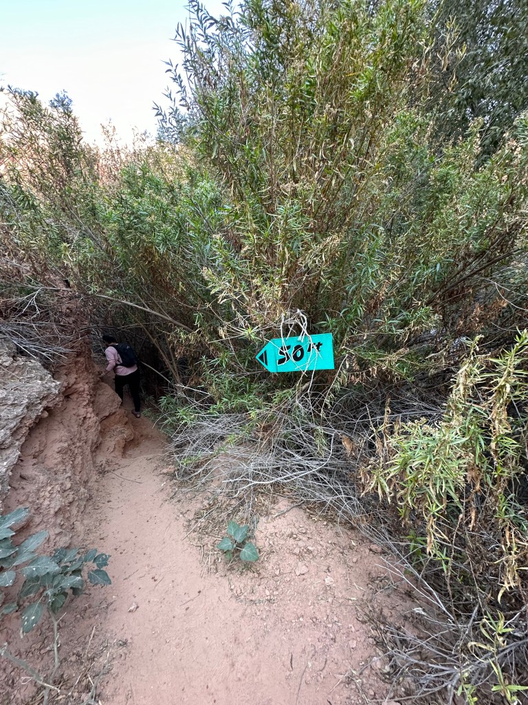
Fifty Foot Falls, along with Little Navajo falls, are newly created waterfalls from a major flood event in 2018 that changed the water flow in the area.
Harder to find, but if you meander enough you’ll get there...
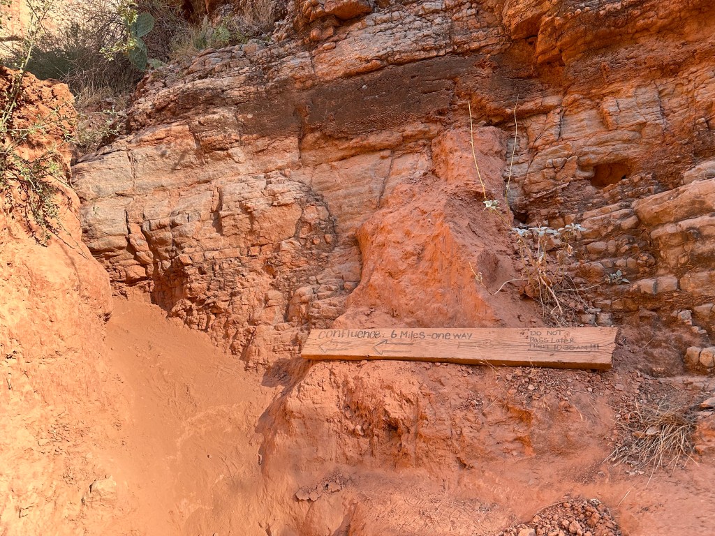
The Confluence is where Havasu creek meets up with the Colorado River, and is a 12-mile round trip from the base of Mooney Falls. I didn’t get a chance to hike this last time around as it was closed during monsoon. So I thought I’d give it a try this time.
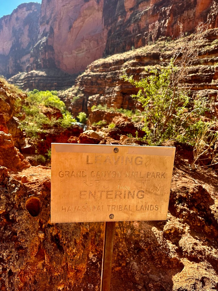
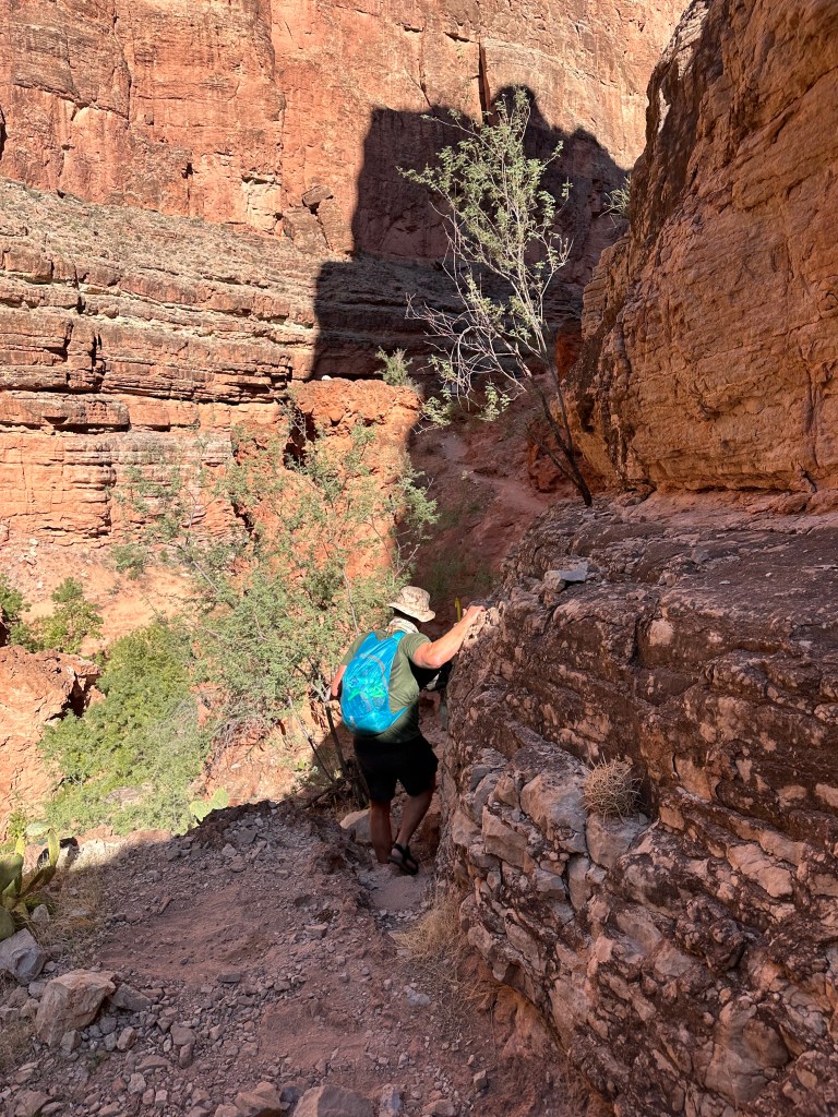
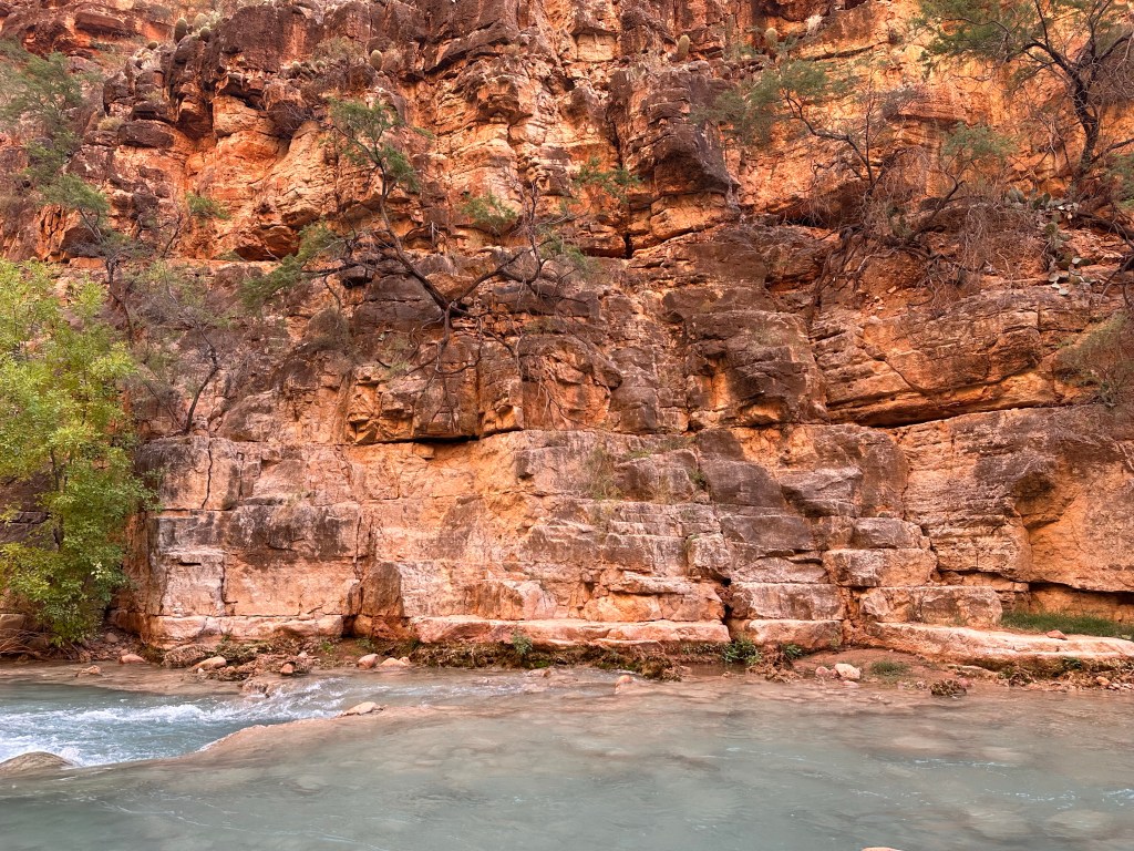
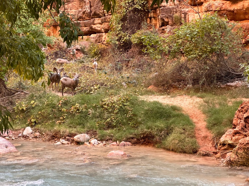
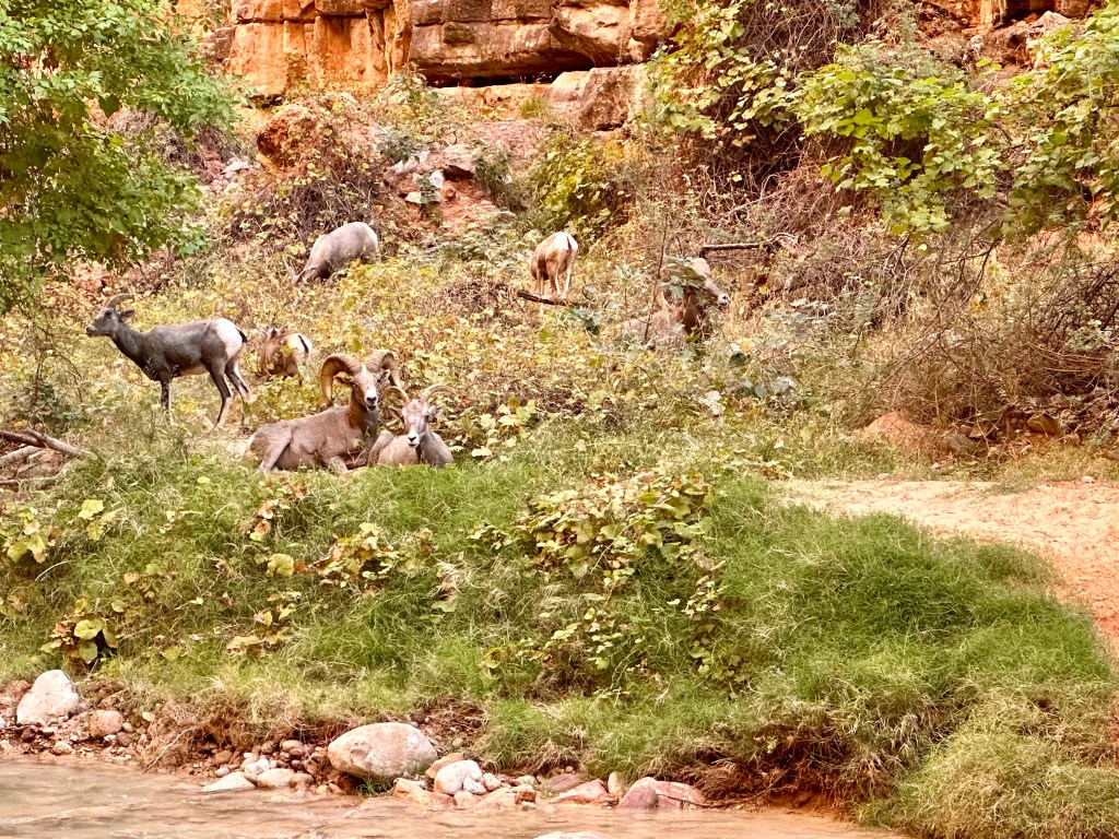
Two miles in from Mooney is where the trail forks. Beaver falls is down to the left, and the Confluence continues on up to the right.Beaver falls. This is where Lori stayed behind since she had already done the Confluence, and I tagged along with a young couple from San Diego to hike onward to the Confluence.About 100 ft from the split you leave Havasupai tribal land and enter Grand Canyon National Park. This is looking at the sign from the other direction. Some Colorado rafting outfitters will bring people to the Confluence and have them hike up to this point. This signage is to warn them not to proceed further as they would be entering private land.Parts of the trail were a bit sketchy.First water crossing starts after scrambling down this cliff.At the second water crossing we saw that our path was blocked by a flock of big horned sheep.Rutting season runs from July through December, and the males get extra aggressive during this time. So our onward path was essentially blocked, especially when the three big ones laid down and showed no signs of moving anytime soon. I wasn’t planning on getting rammed by 1000-lbs of force so we decided that it was best to take our retreat.
This gives me an excuse to return to Havasupai at a later time to finally get a chance to do the Confluence hike. As if I need any justification to return…